
Precision Drone Services
For Land Management

Our Services

Drone/Aerial Pest Control

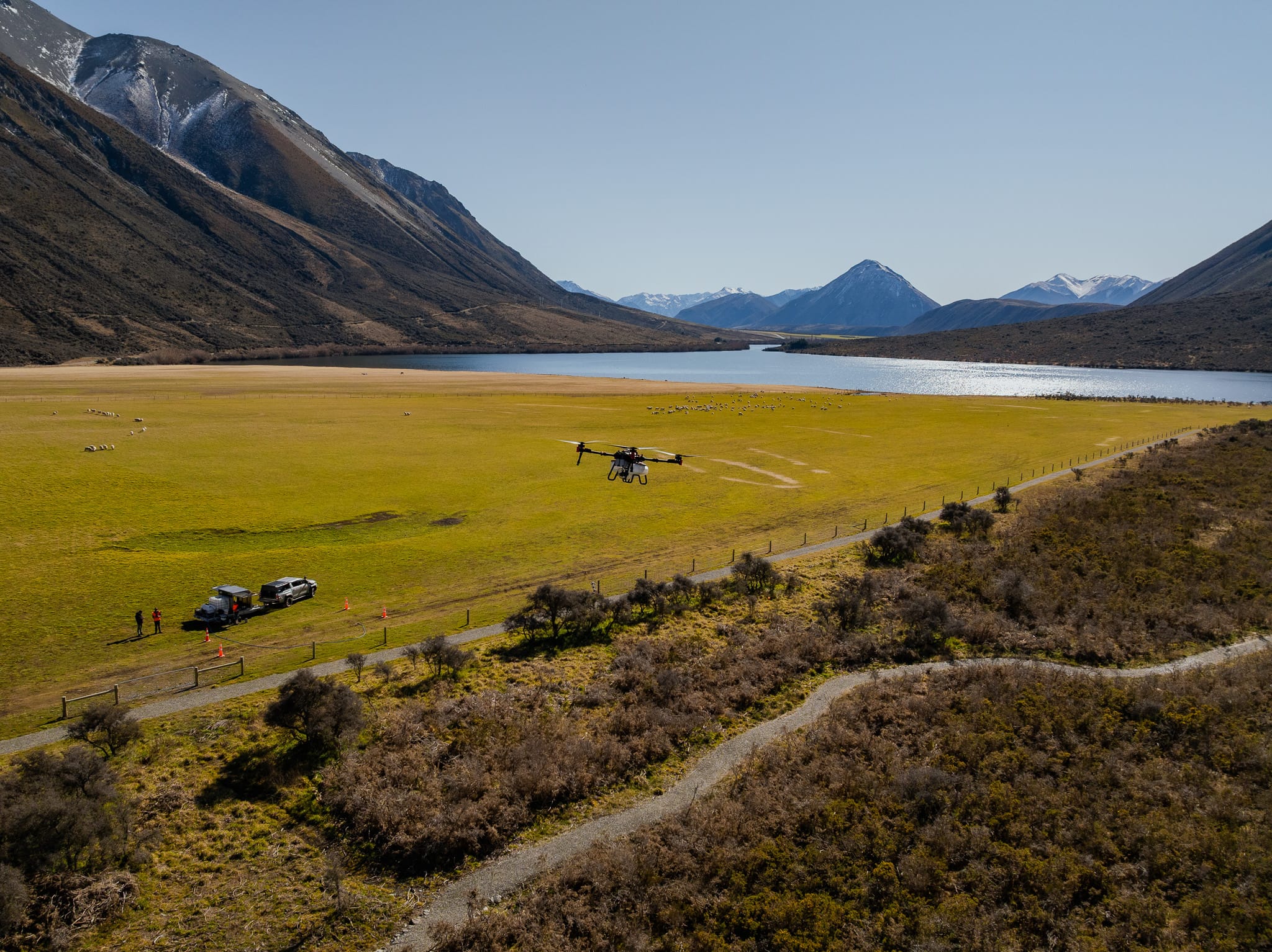
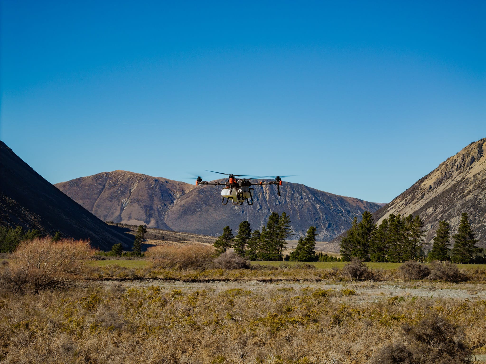
Our drone technology brings precision, efficiency, and access to areas where traditional methods fall short. From aerial spraying and seed spreading to mapping, monitoring and toxin application, we use drones to deliver fast, accurate results across rugged, remote, and large-scale environments.

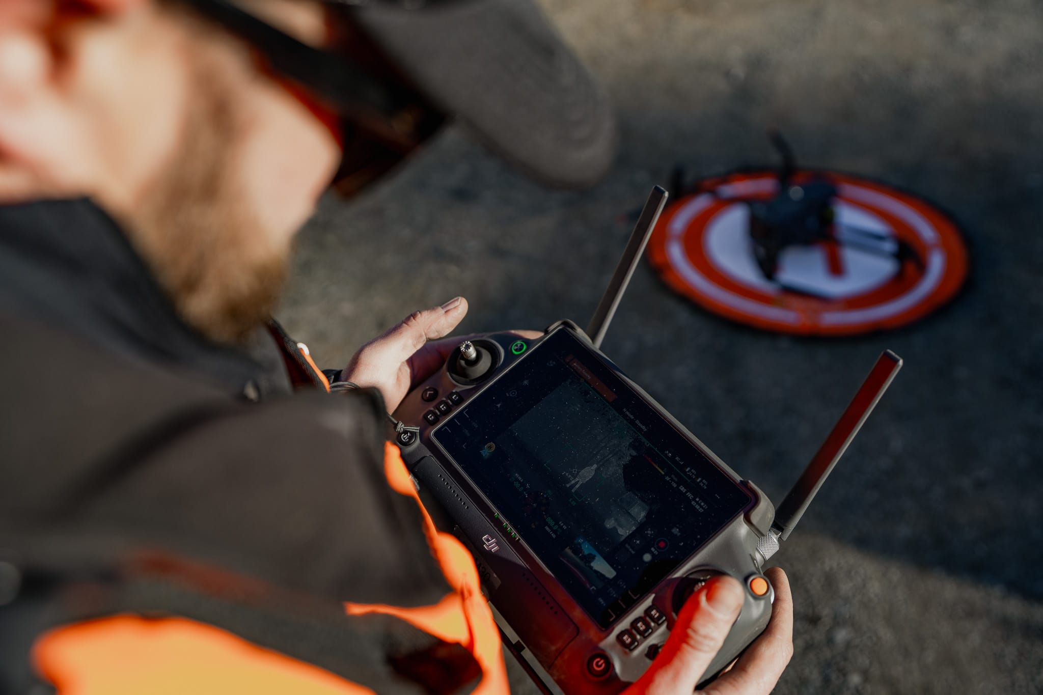
CAA-registered and fully certified, our operators hold chemical and night flying ratings, enabling safe aerial application of herbicides and pesticides as well as a 24/7 operational window for optimal weather and thermal conditions. We work closely with landowners, councils, and environmental teams to tailor drone solutions that reduce costs, increase coverage, and minimise environmental impact.

Whether you’re targeting weeds or invasive animal pests, restoring land, or gathering vital data — our drones are ready for the job.

Drone

Capabilities

Aerial Spraying Of Herbicides And Pesticides

Our industry-leading XAG P100 Pro drone has the versatility to cover all your spray needs, right through from agriculture, forestry, to roof washing. The XAG P100 Pro has your assets covered.

Full proof of placement and track logs can be provided on request.

Specifications:

  • Maximum flow rate of 22L/min
  • Capable of a 60kg payload
  • Rotary atomiser nosels
  • 60L tank capacity
  • Spray width: 10m
  • Flow rate: 22L/min
  • Droplet Size: 65-500 microns
  • Max coverage of 15 ha / hour

Aerial Seed And Fertiliser Spreading

LRC utilise an XAG P100 Pro drone, which gives us the ability to deliver seed and fertiliser spreading in steep slopes, uneven topography and hard-to-access areas.

The versatility of this machine allows us to tackle all tasks from oversowing through to seedpod spreading and toxin application.

Specifications:

  • Tank capacity: 80L
  • Spreading rate: 150kh/min
  • Spread width: 7-12m

Surveying And GIS Mapping

LRC utilise our drone GIS survey and mapping to plan projects, site mapping, perform volume calculations, monitoring and inspections.

Our drones are equipped with high-resolution cameras designed to capture detailed imagery from the air with RTK accuracy.

We have a range of drones that give us the capability to undertake all aspects of surveying and mapping.

  • LIDAR
  • Thermal Imaging
  • 2D and 3D

Thermal Drone Inspections

Longridge Contracting’s thermal drone capabilities are powered by the cutting-edge DJI Matrice series, delivering high-efficiency aerial monitoring with precision and reliability. Equipped with the Zenmuse H30T thermal camera, this platform offers advanced imaging for day and night operations, supported by a robust battery system, allowing us to cover vast areas.

Used for pre and post operation to determine the efficacy of control and pest population densities.

Drone Roof Cleaning

Removing moss, mould and lichen from your roof is proven to protect your asset from premature failure and prolongs the life of your roof. LRC provides safe and effective cleaning of large hard to access roofs, mitigating damage to property and health and safety issues associated with manual techniques.

Our drone-based approach allows us to reach challenging roof areas whilst maintaining the highest safety standards and delivering consistent, thorough cleaning results.

Drone Benefits

Why Choose LRC Drones?

  • Access areas that traditional machinery can’t reach
  • Reduce environmental disturbance
  • Lower operational costs
  • Fast, accurate data and delivery
  • Precision and efficiency

Spray Drone

Features & Specs

Our XAG P100 PRO Agricultural Spray Drone provides aerial spraying and spreading capabilities with the capacity for 60L of liquid and 80L of granular fertilizer, allowing for targeted treatment and efficient monitoring of affected areas. With a swath of up to 10m, the XAG P100 Pro can cover up to 15ha per hour.​

Features:

• Max. Flow Rate 22 L/min
• Droplet Size Range 60-400 μm
• Spray Width 10 m
• Smart technology enables rapid tracking over difficult terrain
• Autonomous spraying and spreading
• Variable spray rates for different areas
• Save chemicals and water
• Increase yield and decrease waste
• Yield mapping and application

Thermal Drone

Features & Specs

The DJI Matrice 30T is a cutting-edge drone specifically designed to enhance animal pest detection through its advanced thermal imaging capabilities. Equipped with a high-resolution thermal camera, the Matrice 30T allows users to detect and monitor pest animals, such as invasive species or livestock threats, even in low-light or nighttime conditions. With its rugged design, long flight times, and real-time data transmission, the Matrice 30T is an ideal tool for improving pest management strategies and protecting ecosystems.

Features:
• Maximum Flight Time: 41 minutes
• Wind Resistance: Up to 15 m/s
• Maximum Speed: 23 m/s
• AI-Powered Features: Includes smart pin, track, and Waypoints 2.0 for enhanced operation
• Service Ceiling: 7,000 meters for high-altitude performance

Safety,

Compliance,

Excellence

We are registered with the Civil Aviation Authority and meet all health and safety standards for aerial and ground-based operations.

Pilot Qualifications
Our certified pilots hold chemical ratings and night flying ratings, enabling us to operate during optimal conditions when weather is more favourable or to increase operational productivity. Night operations are particularly valuable for our thermal imaging work, where most pest detection activities are conducted under cover of darkness for maximum effectiveness.

Quote Form

Need A Quote For Our Drone Services?